
At SeaWire, we’re taking maritime connectivity to the next level.
Our latest innovation lets you see exactly how much 4G/5G coverage your vessel can achieve and how much you can save, based on your sailing routes.
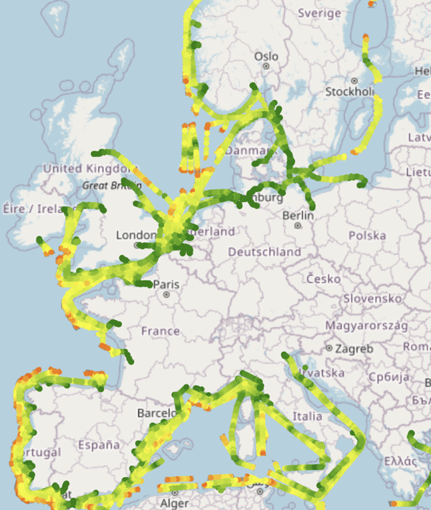
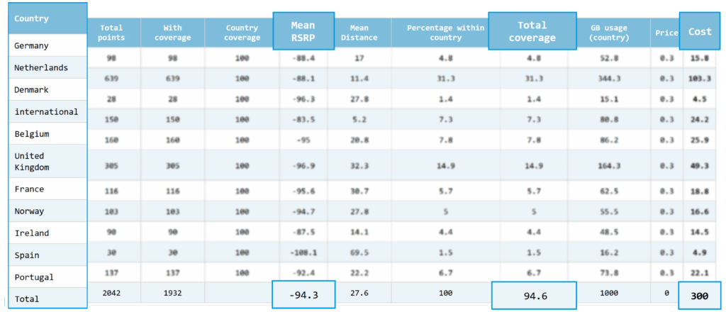
Using GPS data from your vessel’s route history, we calculate connectivity performance for every single point along your route.
That means you get a true-to-life overview of:
Our analysis is based on millions validated historical data. This gives you a reliable, data-driven estimate of the actual connectivity performance and costs, before you install SeaWire’s system.
Two ways to get started
For a start we’d like to demonstrate how our fleet analysis tool works by performing the analysis for one of your vessels.
This gives you a clear, hands-on example of the insights we can provide. If you find the results valuable, we can then go through the rest of your fleet together.
What you’ll receive
You’ll get a detailed report showing:
By understanding where and how your vessels are connected, you can optimize your operations by:
Follow us on LinkedIn or sign up for our newsletter to stay updated on the latest developments in maritime connectivity, new product releases, and real-world case stories from our customers.
Or, contact CEO David Fleischer directly:
david@miwire.net
+45 21262380


Contact us for more information.

Diplomvej 381
2800 Kongens Lyngby
Denmark
+ 45 82 820 820
info@miwire.net
MiWire Group ApS, DK44555395